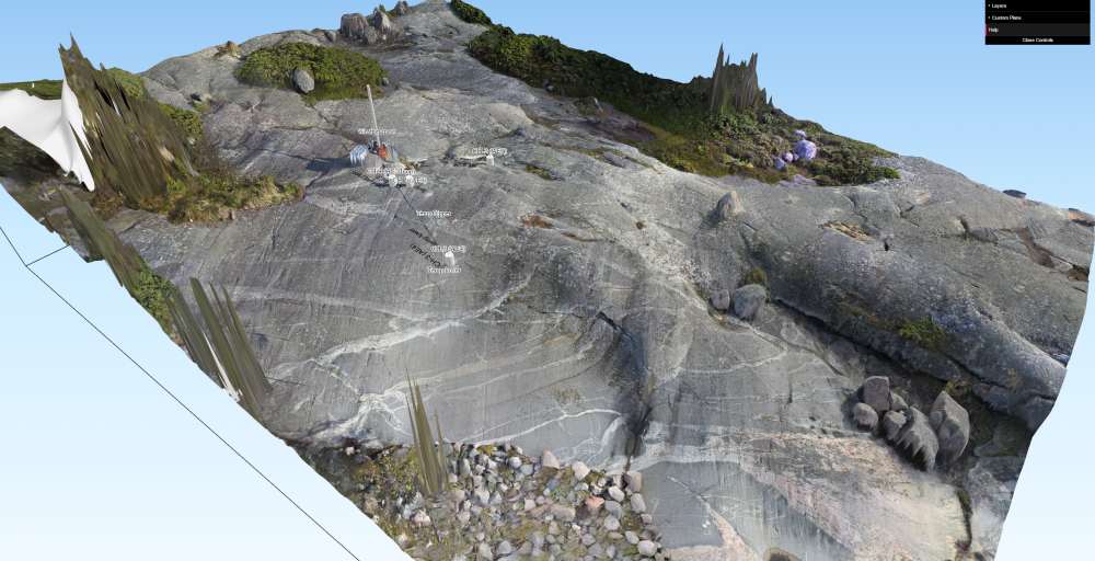
SFM model with our orthomosaic overlain. The view is to the SE, and recent fracturing runs from right to left across the center of the model.
Before the winter set in and a long twilight fell on the Finnish archipelago a group of us from ETH Zurich and Aalto University ventured out to Langören island to winterize the measuring equipment and gather data for numerical and structural analyses of the fracturing events. Following from a recent paper from Gonçalves et al. (2016) in which the authors used a GoPro camera on a 4m pole to capture images to produce a 3D model using structure from motion (SFM) software, we thought we may as well have a go. The setup is remarkably simple, with the fisheye lens ensuring good overlap of images, a smartphone app providing a remote shutter, and the operator maintaining a consistent angle by fixing the camera to the top of the pole and angling the pole with his foot and an outstretched arm. Markers chalked onto the rock surface were surveyed with GPS to provide coordinates for calculation and referencing of the model using Agisoft Photoscan.
We use QGIS, a free, open source GIS platform to add elements of our monitoring system to the model, and the Qgis2threejs plugin for web-based visualization. Below are a couple of screenshots from the orthomosaic and hillshade model, which resolves incredible detail – including glacial striations on the bedrock surface, and relief of weathering-resistant quartz veins. The greatest error in the model stems from the 0.45 m horizontal accuracy of our GPS, which wasn’t referenced to a stable base station on the island. This leads to a slight (2°) rotation of the model, and stretching elements beyond the control point region. Otherwise, the DEM resolution of 6 mm/px, and orthophoto resolution is 3 mm/px. The stated overall error from Agisoft is 0.44 m – significantly better than the 2 m resolution airborne LiDAR otherwise available.
Follow this link to view a section of the model in 3D (it’s a large page, 180 mb, so take care). The hillshade can be viewed by changing the opacity of ‘Langoren_overviewDEM_new copy’ layer in the menu.
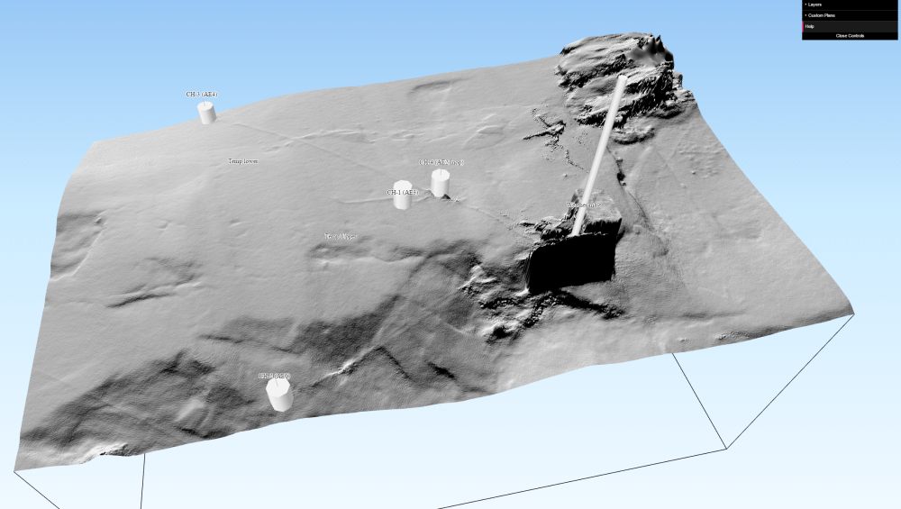
A hillshade illustrating the SFM DEM resolution. The view is to the NNE, glacial striations can be observed running from the north, and cables to the monitoring instruments can be observed radiating from the control box at the weather mast.
Camera used: GoPro Hero3+
Camera settings:
focal length = 2.77
aperture = f/2.8
ISO = 100
Photos used = 312 pictures
Dense point cloud = 98.3 million points
DEM resolution (relative) = 6.45 mm/pix
orthomosaic resolution (relative) = 3.23 mm/pix
overall georeferencing error = 44.99 cm
Recent Comments