
Numerical modelling is an important tool for most natural hazard researchers. Excellent codes now allow scientists and engineering practitioners the opportunity to simulate natural processes in both static and dynamic states.
Read More...stress-driven
Geohazard information for the masses
Author: kerryleith (page 6 of 7)
Candidate: Theresa Raab Supervisors: Kerry Leith, Michael Krautblatter Institution: Technical University of Munich Activity: Completed summer 2013
Read More...This PhD combines geomorphologic and engineering geological approaches to gain a better understanding of rock slopes and associated hazards posing a risk to life and key infrastructure. New insights are expected by integrating material mechanics, in particular stress corrosion, in the assessment of fracture propagation and, thus, instability of rock slopes. We assess conditioning processes […]
Read More...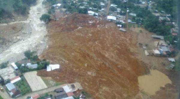
Heavy rainfall from hurricane Manuel initiated a large landslide which struck the village of La Pintada (Mexico) this Monday. 58 people have been reported missing in the small village, and at least 20 buildings have been destroyed. Although helicopters have rescued most of the villagers, 45 people remain, and authorities are concerned that “The rest […]
Read More...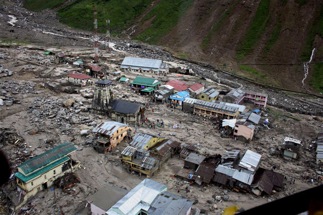
Last week a major debris flow struck the town of Kedarnath, an important Hindu pilgrimage destination in the Uttarakhand region of northern India. One week on, details of the event are ever so slowly beginning to emerge, although the remoteness of Kedarnath, ongoing flooding within the region, and significant damage to infrastructure throughout Uttarakhand, means […]
Read More...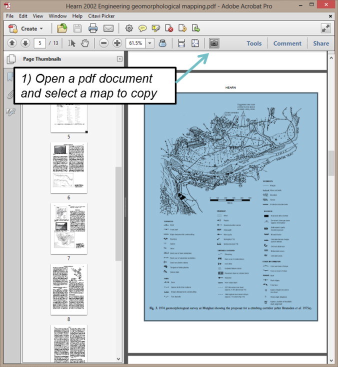
The ‘Image Overlay’ tool is the key to an extremely simple, surprisingly powerful, and somehow little known trick in Google Earth. The tool allows anyone to copy maps out of print documents, drop them onto the terrain model in Google Earth, and then browse the maps in 3D – something that even the authors were […]
Read More...QGIS-SEXTANTE cookbook: Hydrology analysis with TauDEM: To start the year, here is the first external contribution to this blog, a great post about the TauDEM algorithm provider for hydrological …
Read More...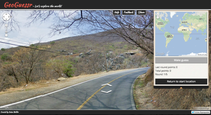
GeoGuessr provides a natural change of pace for a Sunday blog, though it’s also a great chance to highlight the growing coverage and interesting applications of Google Street View. GeoGuessr is a Google Chrome experiment from Anton Wallén which allows you to test your geographic knowledge against the Street View data by dropping you into five random scenes, and […]
Read More...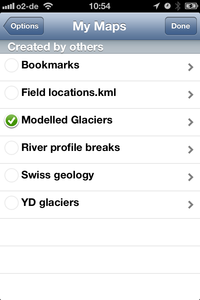
Things are moving fast in the mobile world, and the last couple of years have been particularly progressive in the rather specific, but somehow exciting world of mobile GIS. This is allowing practitioners to tighten the loop between desk investigation, field study, and reporting, as mobile devices provide access to traditional reference data in the […]
Read More...© 2026 stress-driven
Theme by Anders Noren — Up ↑
Recent Comments